| Date: | 14th. January 2007 | |
| County: | CORNWALL | |
| Location: | St. Agnes (Jericho Valley) | |
| Type: | Scenic Area (Woodland) | |
| Sub-Type: | Trees, Stream, Headland | |
| Viewed by: | WALK from car park | |
| Car Park: | Free? | |
| Difficulty: | Easy, but can get muddy. | |
| Distance: | xKm | |
| Season: | Winter | |
| Weather: | Light cloud becoming overcast. | |
| Time Of Day: | Late Afternoon To Evening | |
| Camera: | Casio Exilim EX-Z850 Pocket Zoom (JPG) | |
| Scene Rating: | ••••• |
Since getting a little digital camera for Christmas 2006, we've been talking photos of our country walks. This is the walk we made on the 14th. January 2007, only about a mile from our house in Grenville Drive, Wheal Kitty. It was the first day of 2007 with periods of strong sunlight, but the weather was still unpredictable. The sun alternated with cloud and even some showers, so our record of the walk was rather "patchier" than we would have liked.We started by striking north, and walking the half-mile to the nearest cliff-tops. Dropping down into the valley which ends at Trevellas Beach, we then crossed the stream in front of the Blue Hills tin mine, before climbing up the side of the hill to Trevellas Point.

The stubby vegetation is typical of that along the northern Cornish headland: denuded by the wind and stunted by the stoney spoil thrown out from centuries of tin mining.Although the view down the rocky beach to St. Agnes was overcast and hazy, the sun over Trevellas enabled Xue to take in a few rays, before we finished the climb to the crest.

But as soon as we reached the old anti-aircraft positions at the edge of the airfield (now just used for gliding,) a heavy shower came in and drove us down the hill again. We took a bridleway down between the walls and hedgerows...

...until we reached the little bridge by Jericho Cottage, at the bottom of the valley.The bridge crosses the same stream that we'd crossed earlier, further down by Blue Hills.Two paths intersect here. One runs down the northern side of the stream, while the one we'd just descended continues across the bridge back up to Wheal Kitty.

In the little valleys, the shelter from the strong winds gives rise to vegetation which is quite different from the nearby uplands. Often you can find light woodland.

Although the sudden downpour had been heavy, and had stung us as it was whipped inland by the gusty wind, we weren't especially wet. So after a quick break on a fallen log...

...we continued along the side of the narrow stream.There are rumoured to be small trout in the clear and fast-running water - refugees from a trout-farm upstream. But despite a lot of peering, we still couldn't see any.

Further along the path forked. One way continued along the stream, while a drier path turned up the hill, describing a broad curve along the edge of the trees. Since it was sunnier, that was the path we took.

The trees here have a thicker girth, but still with a thick cladding of ivy.In the summer they are probably quite shady, but the fallen leaves do nothing to prevent the entry of the thin sunlight during the short days of winter.

As you reach the top of the hill, the taller trees give way to shorter ones, with their crooked branches spreading from almost ground level.

Frequently these are gnarled and thorny, although their grey bark and red fruit can cut a strong profile against a clear blue sky, giving an austere Wordsworthian beauty that evergreens can't match.

The wooded path soon gives way to unpaved tracks: stoney, but smoothly rutted by farm vehicles delivering winter hay to the livestock and horses. The green paddocks, with their wooden 5-bar gates, are bordered by these rough shrubs, interspersed by gorse.

As you join the narrow tarmac'd road to the primary school above the curiously-named village of Barkla Shop, the hedgerow becomes lower and more uniform, giving it a lonely look. Unlike the woodland tracks, which give a sense of comfortable solitude, roads like these give an isolated feeling - as if you are travelling to the cold horizon of an unknown destiny.

The main road back to St. Agnes is dangerous to pedestrians, since it's writhing curves hide them from drivers dazzled by the low evening sun.So we passed through the village, and took the bridleway down the opposite side of the stream running to Jericho Bridge.Despite being less than 100 yards from the path we took earlier, the ambience was quite different.

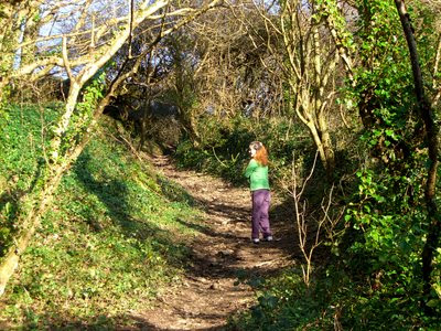
In the wetter ground to the left of the path, the trees spread angular branches, with skinny fingers reaching down into the roughly tangled grass.

The track too was soft and muddy from the recent rain. The sun's dying rays seemed not to reach here to dry it out.

Cornwall,
Stream,
Trees,
Trevellas,
Walk,
Woodland

No comments :
Post a Comment